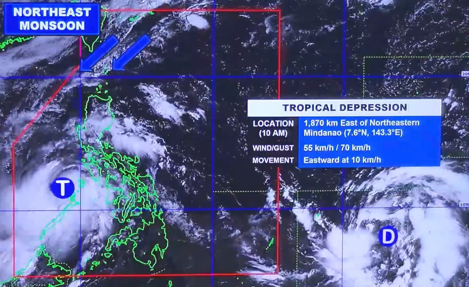
MANILA, Philippines — The Philippines is closely monitoring a tropical depression still outside the Philippine Area of Responsibility (PAR), which could intensify into a super typhoon in the coming days, according to the Philippine Atmospheric, Geophysical and Astronomical Services Administration (PAGASA) on Wednesday, November 5.
The tropical depression was last spotted 1,835 kilometers east of northeastern Mindanao with maximum sustained winds of 55 km/h and gusts of up to 70 km/h, moving east at 10 km/h. PAGASA said it is currently “looping over the Pacific waters south of Guam” and may continue to move erratically for the next 12 to 24 hours.
The system is forecast to strengthen into a tropical storm later Wednesday, a severe tropical storm by Thursday, a typhoon by Friday, and potentially a super typhoon by Saturday, November 8.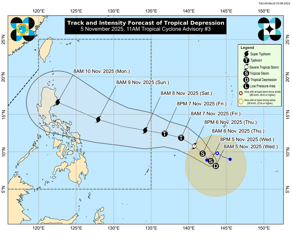
Once it enters the PAR, likely late Friday evening or Saturday morning, it will be given the local name Uwan.
PAGASA warned that there is an increasing chance of landfall in Northern or Central Luzon by Monday, November 10, though the track remains uncertain. Tropical cyclone wind signals could be raised as early as Friday evening or Saturday morning over parts of eastern Luzon and Samar Island to give residents time to prepare.
If the storm becomes a super typhoon, the highest alert level, Signal No. 5, may be raised.
Weather conditions are expected to deteriorate by Sunday, November 9, with potentially life-threatening winds and heavy rains in parts of Northern and Central Luzon by Monday and Tuesday, PAGASA said.
The bureau also warned of possible storm surges along the northern and eastern coasts of Luzon, while rough to very rough seas may affect seaboards across Luzon, the Visayas, and Mindanao starting Friday or Saturday.
PAGASA urged the public to remain vigilant and monitor updates, as forecasts may still change in the coming days.