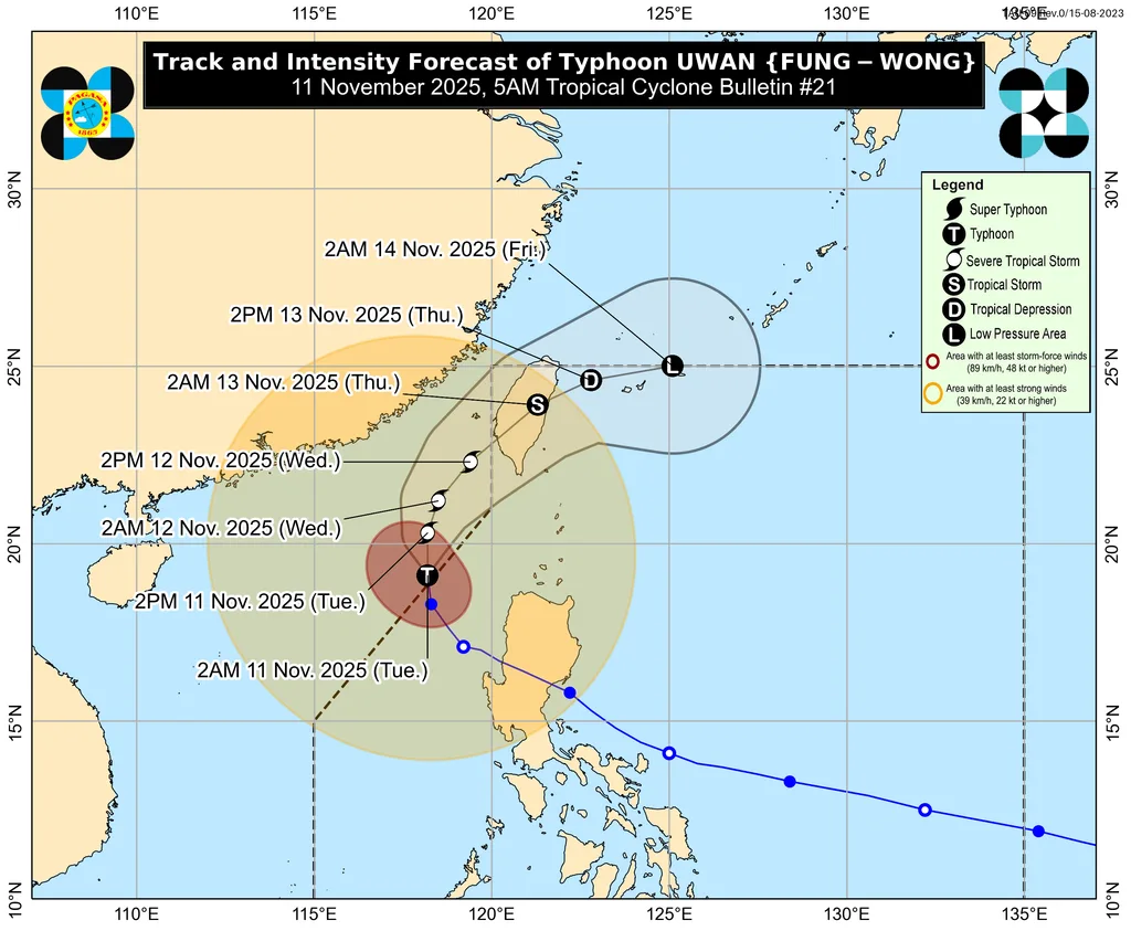
MANILA — Typhoon Uwan (international name: Fung-wong) has exited the Philippine Area of Responsibility (PAR) on Tuesday morning, but its outer rainbands continue to bring strong winds and heavy rains to parts of Northern and Central Luzon, according to PAGASA.
As of 10 a.m., Uwan was spotted 355 kilometers west of Laoag City, Ilocos Norte, moving northwest at 20 km/h with maximum sustained winds of 150 km/h and gusts reaching 185 km/h.
While it weakened slightly after crossing Luzon, the typhoon’s wide circulation continues to enhance the southwest monsoon (habagat), causing rain and gusty winds over Ilocos Region, Cordillera, Central Luzon, and Metro Manila.
PAGASA also warned that Typhoon Uwan could reenter PAR later this week as it recurves eastward near the Ryukyu Islands, though it is expected to be significantly weaker by then.
“Even if it’s technically outside PAR, Uwan’s lingering effects will still be felt across large parts of Luzon,” PAGASA said, urging the public to stay alert for possible floods and landslides in rain-soaked areas.
Maritime authorities advised fisherfolk and small vessels to avoid sailing over the western seaboards of Luzon due to rough to very rough seas.